Menu
To see this page in your own language use the following translation bar.
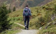
Walking Routes around Ojén and Marbella
There are many beautiful walking routes in the area around Ojén, Marbella, Istán and Elviria.
There is a marvellous free 163 page guide to walks in the area, containing full details of 25 routes with full colour photos, in English and Spanish. It is published by the local tourist authority and is free. You can download it as a PDF from this site; it's a 12MB PDF so it takes around 3 minutes to download, but it is worth the wait. You can download it now, just click here
Thee is now a new app for Android and IOS called ‘Costa del Sol Málaga’, a free tourist guide that shows 103 towns of the Province of Málaga, Spain. The free and multilingual app (in Spanish, English, French and German) has been developed by the Malaga County Council. It provides tourists with the exact location of all tourist places in the towns of the Province of Malaga. It will guide you from one small town to another, show you their streets, churches, fountains, corners, and tell you legends and stories. You can find full details and download the app on this link
Another great guide is the guide to the Great Málaga Path. This path, La Gran Senda de Málaga, is divided into 35 stages and has a total length of 656kms. The nearest stages to us are stage 31 Marbella-Ojén (17kms), stage 32 Ojén to Mijas (40kms), stage 33 Mijas to Benalmádena (18kms).
There are some fantastic detailed guides to the path and the birds, butterflies and dragonflies you can see. They are available in English, French, German and Spanish.
You can find full details of the path and links to the guides on my Great Málaga Path page.
There are some marvellous videos of walks in the province of Málaga on the GPS Málaga YouTube page. Clicking on a video will take you to the video in YouTube and there you will find, under the video, details of the route and a link to the Wikiloc page where you can download the route for your phone or navigator.
The Mijas town hall have signposted 7 colour coded routes in the Sierra de Mijas. The routes range from an easy 1 hour walk to a fairly difficult 5 hour route. All of the routes start at “El Mirador de Mijas Pueblo” (a viewpoint on the A387 road just behind Mijas)) and cover different parts of the southern slope of the sierra.
Full details and downloadable routes can be found on my Mijas Hills View page.
Marbella town hall have signposted 6 colour coded routes in the Sierra Blanca. Maps and full details are available on the Marbella web site, in English and in Spanish.
Links to these details and downloadable routes for viewing on Google Earth or downloading to your GPS or phone can be found on my Marbella Hills View page.
The Sierra de las Nieves has a large number of walking routes around Ojén, Istán, Benahavís and Ronda, well signposted and well described. The official web site is in Spanish but I am producing detailed descriptions in English, with automatic translation to most languages, maps and downloadable GPX files.
You will find all of the routes I have translated so far on my Las Nieves Hills View page.LINKS TO SUBMITTED WALKS AND PHOTOS
The illustrated walks submitted by local residents include photos, downloadable routes in GPX format, links to display them on Google Earth and other useful details.
All of the walks submitted so far can be found on my Illustrated Walks page.
Useful Information for Local Residents

© 2019 Graham G Hawker
Privacy Policy